Physical Environment
Landforms
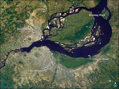
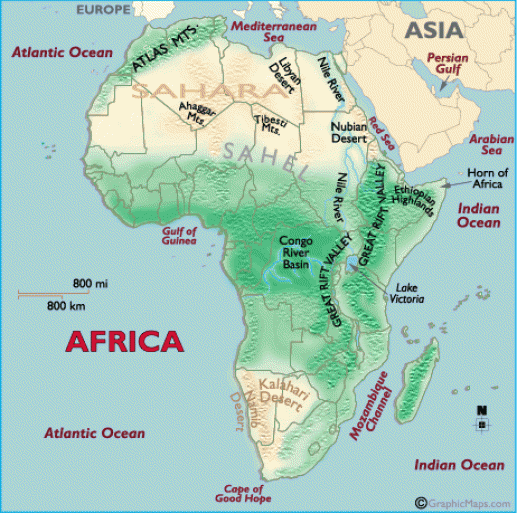
From the grass of the narrow coastal plains, the land rises into a south-central plateau, and the elevated regions along its border with Gabon. Further inland and north, the land flattens out again, and is covered by a dense equatorial rainforest. The Congo River, and its major tributaries , fill the land. The entire river basin is swampy, and often flooded in the rainy season.
Highest Pt:Mt. Leketi (1040 m)
Lowest Pt: Atlantic Ocean (0 m)
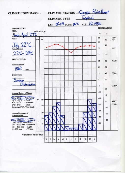
This is a form of a Climate graph. It shows quite lot of information on rainfall and temperature, and is used quite commonly used.
The Congo basin, has been in a period of drought, which started around the second half of the twentieth century. In the Congo Basin as a whole, comparison of data for the periods 1951-1969 and 1970-1989 has shown a rainfall loss of 4.5%.
SOIL
The lower catchments of the Congo basin vary in their geology.
In the North, the Oubangui sub-basin is a 'ferruginous cuirassed peneplain'. This is a kind of soil which drains easily. Further South, the Shangha sub-basin has a sandy soil which can become partly flooded when it rains heavily. The third kind of soil is nearer the river mouth, and is a plateau consisting of sandstones.
The drought has not had the same impact in the three regions. In the first, the soil of the Oubangui sub-basin amplifies any variation in rainfall. The sandy soils have a stabilizing effect, because they store or release water.
